The 2nd meeting of the DMU boundary and goal advisory board took place on Sat. Feb. 21 at the Stevens Point Ramada Inn in Stevens Point. 15 of the 17 original members were in attendance.
The focus of this meeting was to generate a recommendation for Deer Management Unit (DMU) boundaries and the over winter population goals for each DMU.
First on the agenda was the boundary map of the 133 DMU's across the State and what our panel thinks is the proper method of addressing those boundaries. Our options were:
1. No change (Stick the current DMU map in deer hunting regs. booklet)
2. Aggregate DMU's (combining neighboring DMU's in groups of as few as 2 and up to as many as 5 to make fewer DMU's that are larger in size)
3. Other ( an alternative plan derived by our DMU board )
Option 1 was later changed at my request and was defined as no change to the current DMU map
**BUT** keeping multiple sets of books that represented several different deer management unit sizes. One set of books would tally and make population estimates from the current DMU map of 133 unit. Another set of books would tally and make population estimates from an aggregated map of 40 larger DMU's ( see map below) and a third set of books using one DMU called the "Entire State" which represents the largest possible sample size that can be gathered.
My reasoning behind this idea stems from the audit done of the deer population modeling method (SAK) in which the audit team surmised that the SAK ability to estimate the deer population could be improved if larger sample sizes were collected during the gun deer season. Currently the DNR collects the data from 133 DUM's and tries to estimate the population 133 times (once in each DMU). The audit team felt that increased accuracy could be had if a larger number of samples could be collected. This is why the DNR' deer committee came up with the concept map below. The concept was to increase sample size by combining DMU's.
The other reason I recommended this ideas was because hunters have long wanted smaller DMU's to better reflect their particular hunting environment so I knew that selling the idea of larger DMU's with only the hope of increased accuracy was not going to go over well with the public but studying the aggregation concept and testing it on paper for a few years would either prove or disprove whether this was the correct route to take. If after 3 years of data, DNR could show that better estimates and more accuracy are the result of aggregation, it would be easier to get the support of the hunting public and increased confidence would be the result.
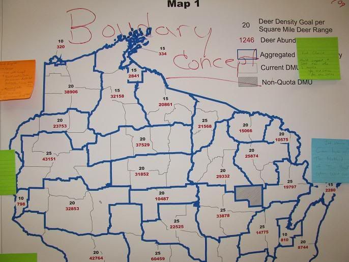
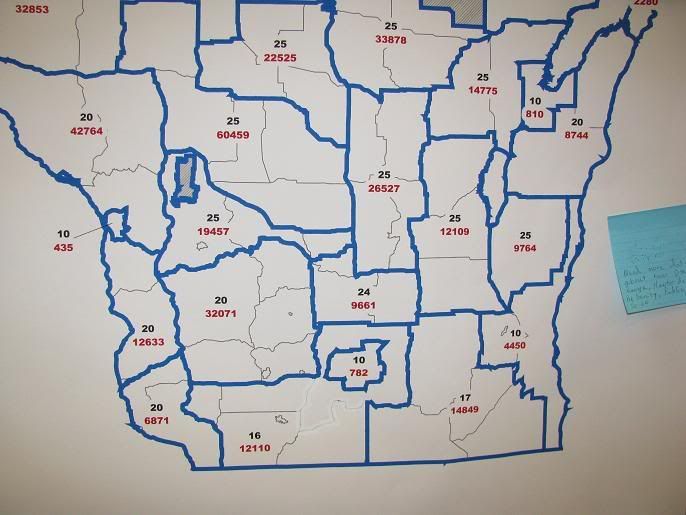
Here are two photos I took of the map on the wall showing one concept of DMU aggregation
***Important*** This map was generated by the DNR but
DOES NOT mean they recommend aggregating units at this time. This map is only
AN EXAMPLE or one concept of what an aggregation
COULD look like. The DNR deer committee has not yet made it's set of recommendations.
The wide
blue lines shows the boundary of a group of aggregated DMU's and the thinner grey lines show existing DMU boundaries.


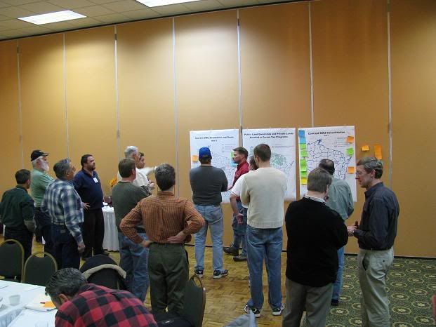
Plenty of time was spent gathered around the maps to discuss the options and lots of ideas were suggested.

After an entire morning of deliberations, we were asked to vote on the 3 concepts for DMU boundaries. The result was:
14 votes for concept number 1 (no change but keep 2 sets of books)
1 vote for concept number 2 (unit aggregation)
0 votes for concept number 3 (other)
I consider it a great first step that our advisory board will recommended no change to the current map. Soon the DNR deer committee will make their recommendation as will the Great Lakes Indian Fish and Wildlife Committee. The public will get a chance to vote on the exact issue at a series of meetings around the State. For a listing of dates, times and locations for a meeting in your area or a meeting in the DMU where you hunt. You can go to this link.
http://wisconsinoutdoor.com/smf/index.php?topic=2327.0The next item on the agenda was recommending population goals in each DMU. We knew the day was too short to set over 100 population goals for all the DMU's on the map so we focused on broad stokes or lumping of DMU's with the knowledge that in March, the general public would also be making their recommendations for population goal adjustments as well as the other committee's tasked with the same mission.
A large map of the state and the 133 DMU's was taped to the wall and each member was asked to place a mark on each DMU they felt required a population goal change. A green marker was used to indicate an increase in population goals and a black marker was used to show were a member felt a decrease in population goals should take place.
I watched as the members walked up to the map and made their marks and when finished, a "Last call" was given to make any changes to the map. I then used the green marker (increase population goal) and drew a line around the entire map indicating a desire to increase over winter population goals in every unit. I suggested an across the board increase of 10% from the current goal population of 737,000 which would raise the State wide over winter population goal to roughly 811,000.
We then discussed the marks on the map made by the members and recorded the areas indicated as needing increases or decreases in goal populations and why we marked the map the way we did. The stakeholders representing the plant communities (flowers, saplings, vegetation) as well as those representing farm and forest interests, made marks indicating reduced population goals and while I did not watch every mark made, I did not see this group of stakeholders advocate any increases on the map.
Those representing the hunting community made marks indicating areas of desired increased population goals. From the comments made while marks were being made on the map as well as from the discussion afterward, those indicating a desire to lower goals were doing so out of a desire to lower the current population and there is a real difference between current deer populations and current goals. They felt that in the past 10 years that an over abundance of deer have done a good deal of damage to the landscape and that a reduction in deer numbers was needed to meet their objectives. What I discovered is that it was not the goal they objected to but rather the amount over goal that we have been in recent years.
I made the case that since we had been over goal in most of the State for many years that we have no idea what "At Goal" looks like and what it will mean to their interests once goal populations are reached. There is a real difference in lowering the current populations and lowering the current population goals. I felt this was a point being missed by many on the board. I knew I had made my case when after the meeting, a member representing the plant stakeholders approached me and said that even though he had marked the map for goal decrease that he was really hoping for a population decrease from the high population levels of the early 2000's and that he could now support the idea of NOT lowering population goals since we don't know if meeting the current goals will still cause problems for this interests. I considered that a success.
After the meeting, I spent time talking with those representing the hunting community and we felt that progress had been made and that each member feared that there would be a strong push for a reduction in populations goals and that after the days events, the tide was turning.
The next meeting of the DMU board will take place on April 25th and will again be in Stevens Point. Between now and then, we are asked attend as many of the March, public DMU meetings around the state as we are able. I plan to attend the meeting in Portage County covering units 57C, 62A and 65A as well as the meeting for Waukesha, Kenosha, Racine, Walworth and Milwaukee Counties involving units 77B, 77C, 77C-CWD ans unit 77M
This is an opportunity for all members of the public to make their wishes known. I encourage all to attend.