Author Topic: Map showing current estimated SAK numbers (preliminary)  (Read 1002 times)

0 Members and 1 Guest are viewing this topic.

Offline Rancid Crabtree

  • Sr. Member
  • ****
  • Posts: 389
  • Karma: 1
  • Happy to be here
    • View Profile
Map showing current estimated SAK numbers (preliminary)
« on: February 18, 2009, 07:10:08 AM »
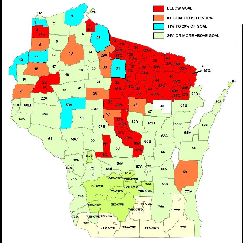
I made this map from the preliminary SAK data as of Feb. 17 2009. Only the 4 colors in the key have significance since most of the change happened north of Hwy 64. I was told this SAK data will be refined / finalized soon. For a bigger and more detailed map, go to.

http://i300.photobucket.com/albums/nn31/WBH_stuff/DMUmap.jpg

« Last Edit: February 18, 2009, 12:22:23 PM by mudbrook »
Any day in the woods is a good day.


Google
Web http://www.wisconsinoutdoor.com